Exploring Historic Antietam Creek
A Journey through Time.

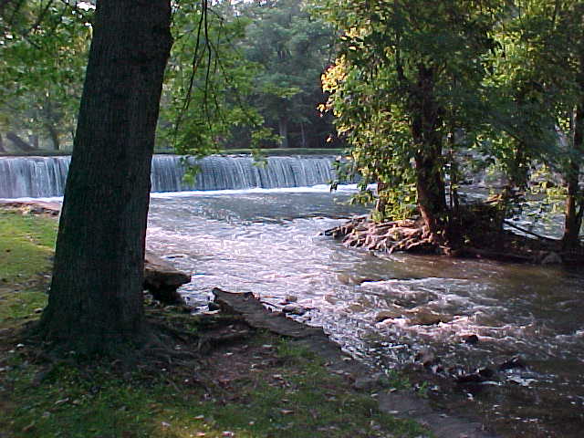
Step back in time as you venture along the banks of Antietam Creek, a place steeped in history and natural beauty. Located in Maryland, this historic waterway offers a captivating blend of significant landmarks, scenic landscapes, and opportunities for reflection.
Antietam Creek played a pivotal role during the American Civil War, and remnants of that time can still be seen today. As you paddle along the creek, you'll pass by the famous Burnside Bridge, a symbol of the bloody Battle of Antietam. Take a moment to reflect on the sacrifices made on these hallowed grounds and the impact it had on our nation's history.
While exploring Antietam Creek, you'll be surrounded by picturesque landscapes that showcase Maryland's natural beauty. The tranquil waters, lined with lush greenery and towering trees, create a serene and peaceful atmosphere that is perfect for reflection and relaxation.
At Historic Antietam Canoe Rentals, we offer a range of canoeing options to suit your preferences. Whether you're a history enthusiast eager to explore the creek's significance or simply seeking a peaceful escape into nature, our knowledgeable guides will ensure a memorable experience.
As you paddle along Antietam Creek, keep an eye out for the diverse wildlife that calls this area home. From graceful waterfowl gliding across the water to elusive deer drinking from the creek's edge, the natural wonders of Antietam Creek are sure to leave a lasting impression.
Join us for an immersive journey through time as you explore the historic Antietam Creek. Marvel at the remnants of the past, embrace the beauty of the present, and create your own memories in this captivating destination.